Week 2: Patagonia ~Chile & Argentina~
- Mary Kate gKing

- Mar 25
- 10 min read
Updated: Mar 30

Overlander: An overlander is a person who engages in a self-reliant, vehicle-based adventure travel to remote destinations, where the journey itself is the primary goal, rather than the destination.
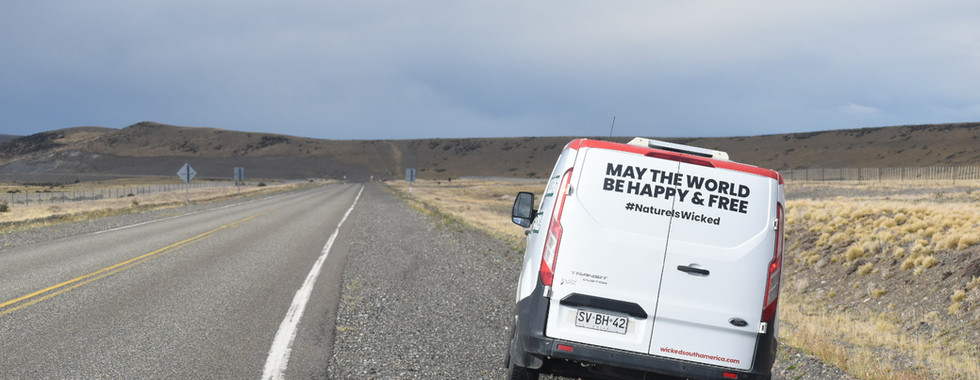
The IOverlander app has been one of the most helpful resources we’ve had on the road. The app & starlink have actually both been equally helpful. This isn’t a sponsorship but just the honest truth. We have been heavily relying on this app due to the need to find wind coverage when parking the van. The wind in Patagonia is no joke. We eventually looked up the definition of overlander and loved it, which is why I started off the week 2 blog post with it. So let’s get into it!

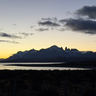
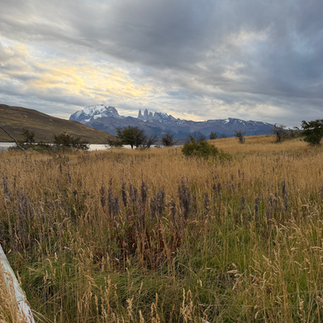
I’ve been soooo excited to write this week 2 blog post. Patagonia might be my favorite place I have ever traveled to! We have officially visited both Chile and Argentina now and are equally obsessed. The breathtaking scenery, wildlife, and friendly people are just some of the reasons why Patagonia has stolen our hearts. I’ll let the pictures attempt to display the beauty of these two countries.


Week 1 Recap: Flew into Punta Arenas from Santiago. Adjusted to the camper van life while creating some funny memories. Amazing boat tour with glaciers & very active whales.
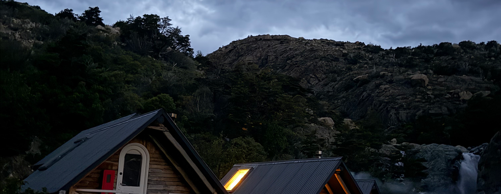
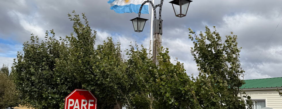
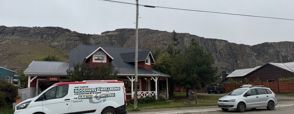
Week 2 Recap: Punta Arenas -> Puerto Natales -> Torres Del Paine National Park (completed W Trek), crossed from Chile into Argentina: El Calafate -> El Chaten (cutest little mountain towns).
What is the W Trek?
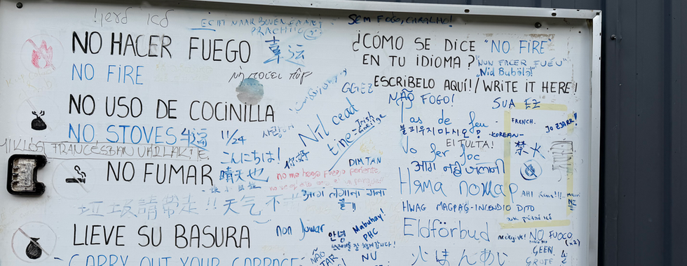
It is a multi-day trek through the Torres Del Paine National Park, which had us hiking 55 miles in 5 days. There are multiple ways you can complete this trek. Options include bringing all your own supplies, renting tents, or staying in Refugios that offer private cabins or hostel-style accommodations. Due to the fact that it was dropping to 38*F while we were there, I pushed for the indoor sleeping arrangements. The camping looked incredible, though, and I’d highly recommend it to anyone in the future who is considering the W trek... or the O-trek, which is the longer version of seeing the Torres Del Paine Parque Nacional.

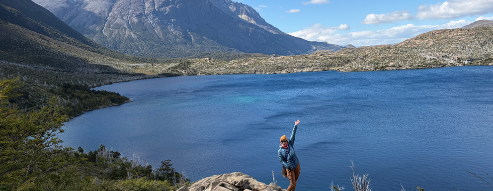
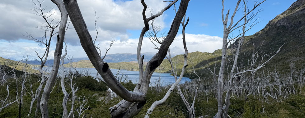
I figured the best way to share the abundance of photos and videos would be to go in order of each day. I would also like to point out that there has been no time for edits for any of these photos. The beautiful blues and greens you see of the water are even more vibrant in real life! Also, peep me flexing my Patagonia bag in Patagonia as much as possible - yes I am a total goober!
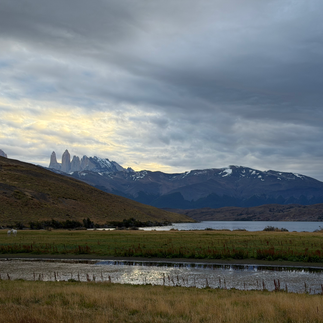
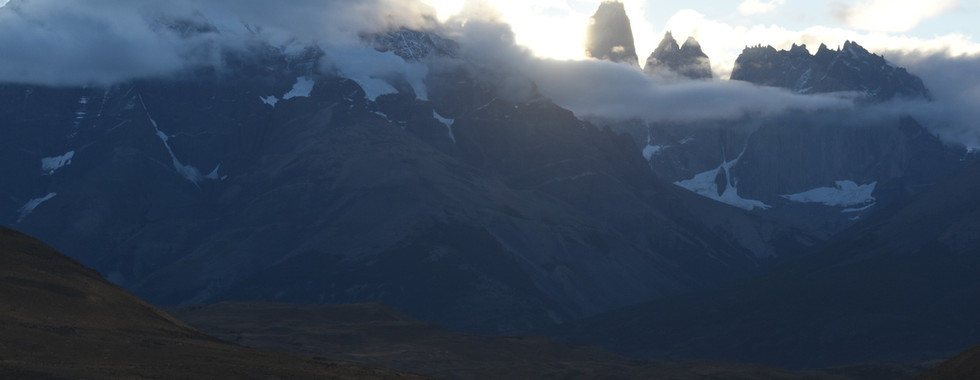
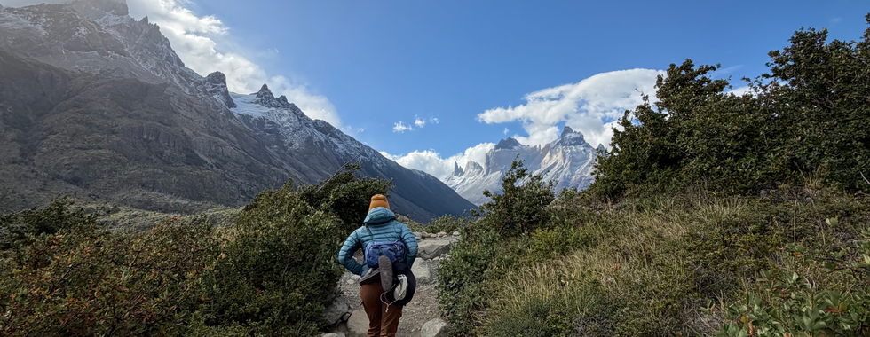
Day 1: Hiking to Mirador Base Torres (14.5miles / 3,600 ft elevation gain).


It was a little cloudy on day 1, so we unfortunately did not see the 3 towers like we were supposed to, but we still enjoyed the turquoise lake and the accomplishment of finishing that challenging hike. Here is a comparison of what we were supposed to see vs what we saw. An excuse to return? Perhaps..


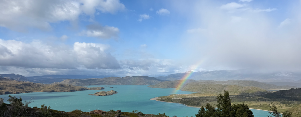
As it goes, because of the on-and-off rain we experienced on our hike on day 1, we enjoyed the most magical rainbows on our drive out.

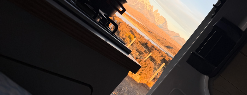
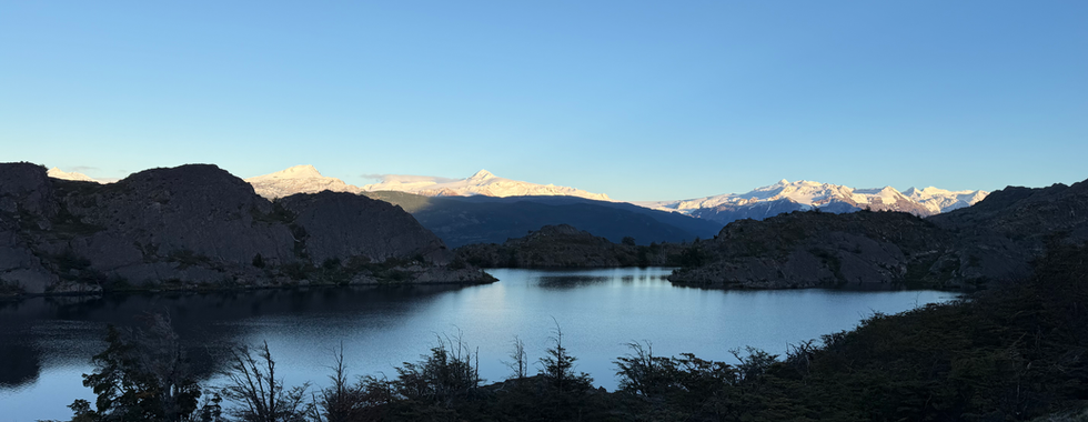
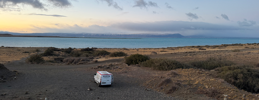
The clouds cleared up, giving us an incredible view of the sunset from where our camper van was parked. We also enjoyed a slow morning on day 2 at our camper van and opened our doors in "bed" to one of the most stunning views I've seen while in my PJs.


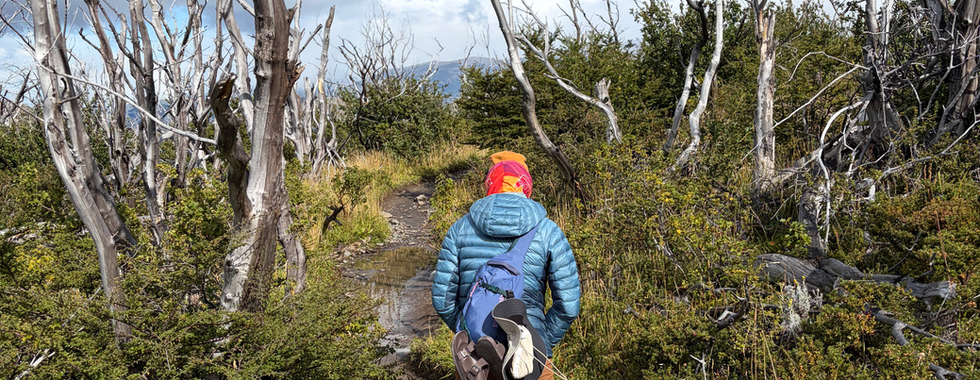
Day 2: Welcome Center to Cuernos (9 miles / 950ft elevation gain)
*Easy Day*
One of the many amazing things we learned and appreciated about the w-trek is that it is a perfect example of "It's about the journey, not the destination". This second day was made to seem like just a step towards getting to the next viewpoint, and boy, were we mistaken. I'll let the pictures show the beauty of day 2's 'simple' hike.


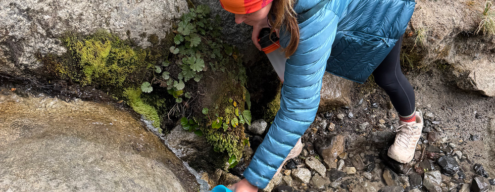


Another cool thing about the w-trek is you can get all your drinking water along the trail from the streams. We used our filtered water bottle just to be safe, but most people filled up without any filters. Let me tell you, there is no better water than fresh glacier water. The first water bottle I tasted after the trek was extremely disappointing.
Now the sleeping arrangements... Day 2 Accommodation: Cuernos Refugio:


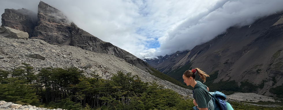
Day 3: Curenos -> Mirador Frances -> Paine Grande
(13.5 mi / 2,160ft elevation gain)
We definitely experienced all types of weather on this trek, especially on day 3 when we experienced a nice little wintery mix, paired with sunshine, wind, and regular old rain.


A Peruvian, three Ausies, and two Americans walk into a bar.... what do they talk about?
Hiking? Travel? Idk, I didn't have a punch line, but we did enjoy some drinks over sunset with our international friends at Paine Grande. Incredible view, incredible vibes, and incredible conversations.. with whatever the heck we talked about.
Now for more pictures of our lodging for night 3.


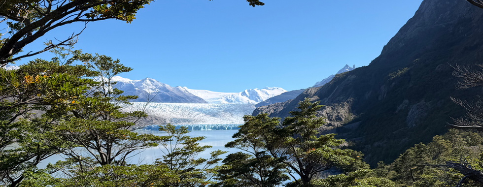
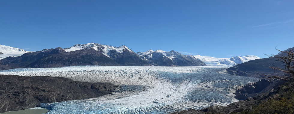
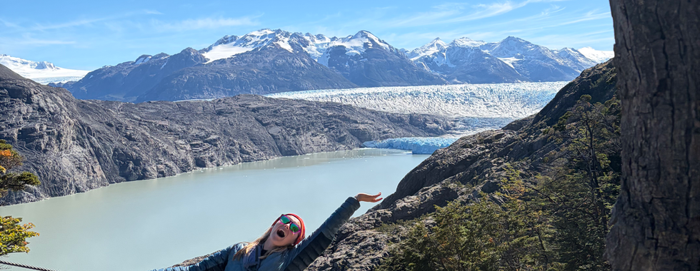
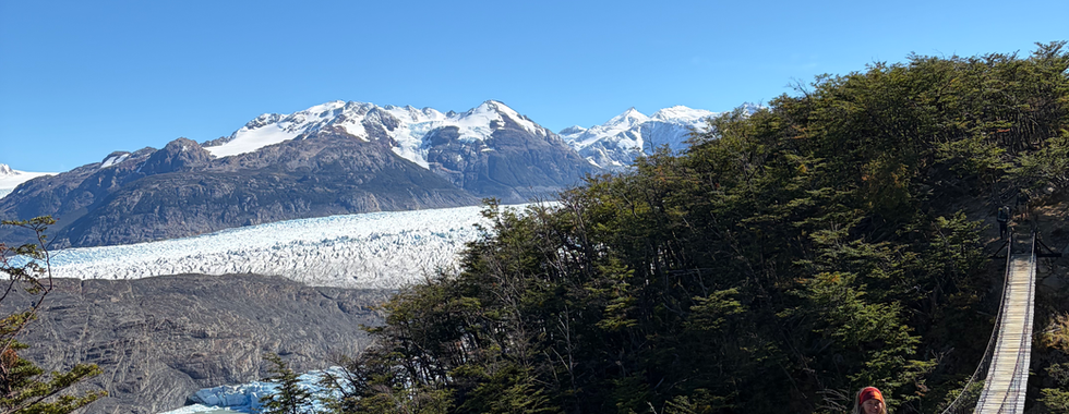
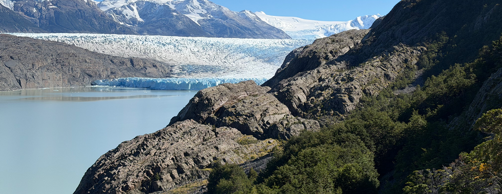
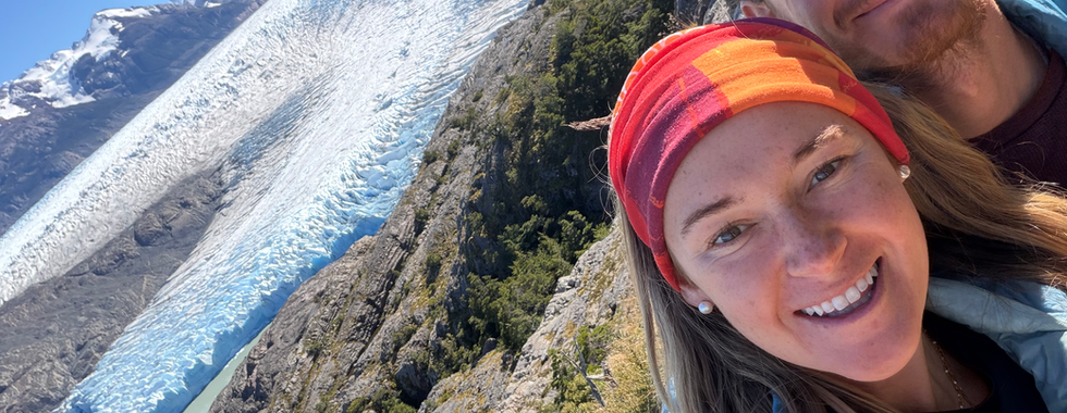
Day 4: Paine Grande Refugio -> Grey Glacier (6.8 mi plus bonus 4 miles to see more of the Grey Glacier Icefield / 1,800ft elevation gain).
Wow. Just literally wow. You'd think after hiking, climbing, and seeing glaciers in both Alaska and Patagonia, that we'd be glaciered out, but Grey's ice field literally took my breath away. Enjoy the pictures from our hike to Grey Glacier.


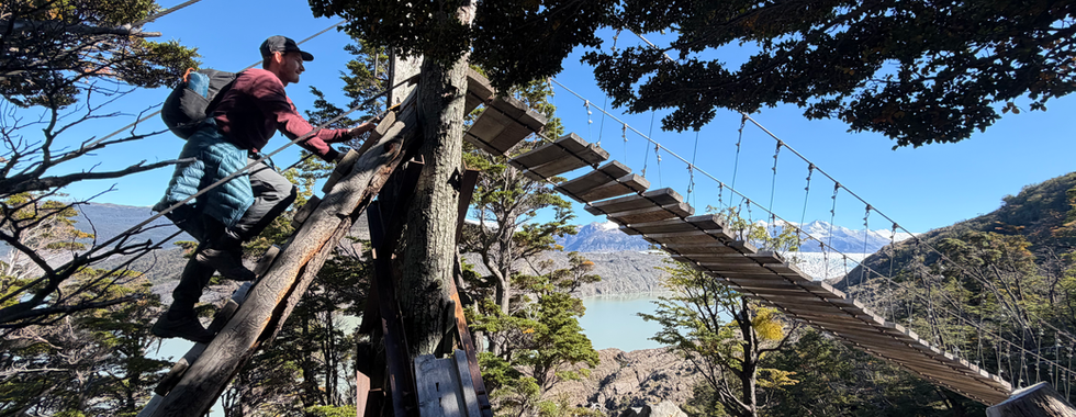


Discussing the activities of day 4, my friends, leads us to our FSOTW....

Funny Story of the Week: Knees shaking. Heart pumping. Hands sweating. Blurred vision staring down at what could be the end. Despite the ringing in the ears, the squeaking of the bridge can still be heard. What do I hear? Is it an animal? Is it someone trying to comfort me to keep moving? No. It is a Chilean man making chicken noises at me. I can still hear the “Bauk, Bauk, Bauk” now.

This story is actually not about me, but written from Nick’s perspective as he stood in the middle of a suspension footbridge trying to understand if the bridge was shaking more with each step.
I stood on the other side, confused by Nick’s hesitation, assuming he was walking so slowly to enjoy the view. I turned to my right in shock while the line to cross the other side had built up, and the Chilean hiker started making chicken noises at Nick. (Definitely playful, with no ill intent). When Nick finally made it across, he said to me, “No me gusta”. The irony of this story is that it was a big smack of karma for the numerous times he’s made fun of his best friend, Christian, and brother-in-law, Patrick, for their fear of heights. I’m sure hearing this story put a big smile on their face.
Day 5: Paine Grande -> Welcome Center
Supposed to be 6.8mi from Grey Refugio to Paine Grande Refugio). We sought out extra credit?
There are not many pictures from our hike down to Paine Grande, part of this is because our first 2.5hours of our hike were in the dark, the other part is directly explained in our LLFTW - Lessons Learned From the Week.
Lessons Learned From the Week: Download trail maps, especially before starting to hike in the dark. The last day of the W-trek was an easy 6.8 miles back to our night four accommodation, Paine Grande, where we would take the catamaran back to the welcome center where we began our trek.
We purchased the earliest boat ticket so Nick could make it back to the van for work. We had an early rise to make it down for our boat departure, giving ourself buffer, we left our Grey Glacier Refugio at 5am. Starting off the hike with my headlamp on, it was definitely eerie being the only ones on the windy, dark trail. Ironically, I joked with Nick, “Good thing we did this hike yesterday, so we know where to go. These trails aren’t very clear and could be easy to get lost”. We were enjoying our quiet and dark morning hike, passing our first round of hikers in the dark. At this point, we had looked down at the sign where it said “usted aqui,” and it was the exact spot we had looked at 30 minutes prior, right before the steep ascend.
Mind started racing as panic set in. How is this possible? Did we really just do a loop? Are we sure this sign is correct? Is this a joke? Are we going to make our boat? Which way should we walk next? Shoot, we don’t have service or a map downloaded.
“Disculpe, Disculpe. Hablas Inglés?” I ran after the speedy hikers that had just passed us. Thankfully, their English was great, being from Germany. We asked where they had just come from and where they were going. This confirmed, in fact, we had just spent the last 30 minutes walking in a circle in the dark. We asked when they had left Grey, and they said 5:40, this meant that with an active pace, we’d still be able to make our boat. They graciously allowed us to walk with them, since they had a downloaded map and were more confident in the direction of the hike than we were.
As we continued to walk, we tried to understand where things went wrong. Funny enough, we had climbed down these rocks that we had originally climbed up 20 minutes prior. Before being aware of our wrong turn, I asked Nick if we were going the correct way, and he reassured me by pointing out the footprints, confirming the correct location. They were our footprints.
As if our egos hadn’t already taken a hit, having to ask for help navigating on a hike we did yesterday. The Germans asked where we were from in the U.S., California? LA? ….. We were so confident in what we had accomplished, hiking over 5 days, just to be asked if we were from LA? Nick’s response was, “What made you think we were from LA? The fact that we are carrying very small packs, only one of us using a headlamp, while the other is hiking, holding an iPhone flashlight.” Our now friend, ***, laughed and continued on with our hike.
Thankfully, we made our boat and were “saved” from a deep spiral that would’ve lasted till 7:45am when the sun finally rose. All is good, we now have new friends in Germany and now know the importance of having a trail map.

So, because of that, we have no pictures from the hike down to Paine Grande. We did, however, get pictures of our unexpected hike back to the welcome center. We successfully made it to our boat time, got on the proper bus#1 for the first stop, only to find out the next shuttle wasn't for another 4 hours. Our option, begin walking, they estimated it to be about an hour and a half walk along the road.
We started our walk, just as it began to rain. Morale on the lower side, we begrudgingly walked in the rain with our hopeless thumbs up. To our pleasant surprise, we were picked up by a nice Chilean man who was driving an empty van to go pick up and privately shuttle some hotel personas. This very well could have been one of our weekly highs. Which reminds me....
Weekly High, Low, Unexpected & Learned:

Nick:
High: Completing the W-trek. It was hard, but overall a great experience. ,
Low: Back-to-back snorer in the Refugios.
Unexpected: How some of the best views were beyond the w-trek (ice field is on the O-trek).
Learned: The American Mink is an invasive species in Las Torres National Park, and the trapping company no longer exists (cough, cough, business opportunity).

Mary Kate:
High: Our mountain cabin at Cuernos night 2 of the W-t,rek. Aside from the amazing views, we went to sleep listening to the waterfall right next to our cabin. OH and it was our my first night not freezing my buns off. Heat = Happy MK & No beanie & coat in bed.
Low: Driving the manual van on one of the most challenging gravel roads I've ever been on. We saw some incredible waterfalls and stayed at a super cool campsite as a result of this drive, but it was still quite the challenge.
Unexpected: How beautiful the hiking was between each highlighted viewpoint. The entire W trek has spectacular views, often 360, not just looking in one direction for a photo.
Learned: Calafate berries can only be found in and around El Calafate. They are used in various ways, including as a Calafate Sour. Similar to the pisco sour, which I learned from our Peruvian friend, Kevin, is debated over between Chile & Peru.

Okay, I know this was a doozy of a blog post.
So much to share after just one week of travel in Patagonia. I'd imagine not every week will be this detailed, but who knows? Vagabonding has been continuing to surprise me!
Do you see now why I said Patagonia has stolen our hearts?
One final photo dump of our days 6 & 7 plus los animales!
Can you spot some of our accommodations for nights 0, 6 & 7 here? Also, how sweet about the priority lanes at the grocery store? Can we get this going back in the U.S ?


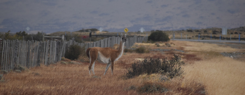
Los Animales
This game of 'I Spy" will have no hints for each photo, but I'll say what is pictured: guanacos (Alpaca family), Rheas (ostrich family), flamingos, sheep, condors, mystery birds;, and the critically endangered South Andean deer.
Fun Fact: Condors have distinct white necks, and a wing span that can reach 10ft long, they are one of the world's largest flying birds.
Not pictured: The numerous groups of wild horses and small birds we encountered on our travels of week 2.


Thank you all so much for reading!
Next week we'll talk more about food & whatever adventures week 3 will bring us!
My IT guy has been on strike for better wages... so I was empowered to create a voice memo link and subscription form on my own. I think I have figured out how to share some voice memos for my audio-lovin peeps. Click HERE and hopefully you can access them?
Same thing goes for the subscription to weekly backpacking blog posts.
If you are interested in getting weekly updates from our travels, Click HERE. Fingers crossed it works, if not let please me know!
Love,
Mary Kate & Nick

Comments